Metropolitan Chicago Accessibility Explorer
Introduction
Project title:
Metropolitan Chicago Accessibility Explorer
Funding:
Metropolitan Transportation Support Initiative (METSI)
National Center for Transit Research (NCTR-USF), through UIC's Urban Transportation Center
Principal Investigator:
Nebiyou Tilahun
Graduate students:
Shi Yin, Moyin Li
Project summary:
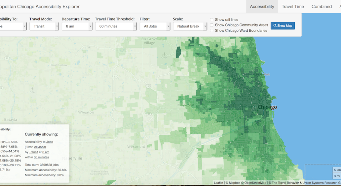
The Metropolitan Chicago Accessibility Explorer measures and displays accessibility to a variety of activities in the Chicago Metropolitan area in a relatively simple, user friendly, online platform. It was designed to be a resource that planners and policy makers can readily use to evaluate how well the transportation system is connecting people to activity locations.
The Accessibility Explorer answers questions about how many jobs, schools, parks, groceries, and other urban amenities can be reached by residents of specific neighborhoods within different time thresholds. One can evaluate the changes to accessibility over the course of a day as transit systems adjust their schedules. It allows us to visualize the spatial distribution of access the transportation-land use nexus currently provides, which areas it benefits the most and which can use improvements.
The tool, through the travel time map, also has the capability to show how far one can travel from different parts of the metropolitan area by different transportation modes. Together with the accessibility explorer, this capability offers the user the see where changes in land use can be made to alter accessibility to jobs or other opportunities for different origins.
Source: Tilahun, N.; Yin, S.; Li, M. (2016). The Metropolitan Chicago Accessibility Explorer: Final Report. Department of Urban Planning and Policy, University of Illinois at Chicago. URL: http://urbanaccessibility.com/accessibility/final_report.pdf.