UPP 461 | Spring 2021
Final Project Showcase
In Spring 2021, the class produced 9 team and individual projects on a variety of topics. Teams have several weeks at the second half of the semester to develop research questions, investigate the topic of their interest, explore GIS tools to address their questions, and produce the final visuals. Thanks to all the students for your hard work during the semester.
Instructor - Andrea Craft
2. Infant Mortality & Access to Perinatal Care in Chicago Community Areas Heading link
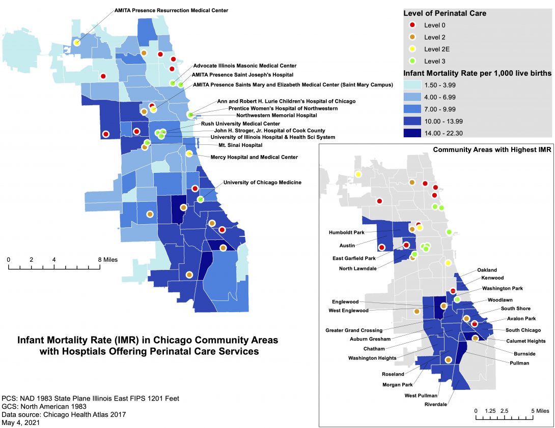
Authors: Eunhye Lee, Lisa Haen, and Aeysha Chaudhry
3. Disability and Equitable Access to Public Transit in Chicago, IL Heading link
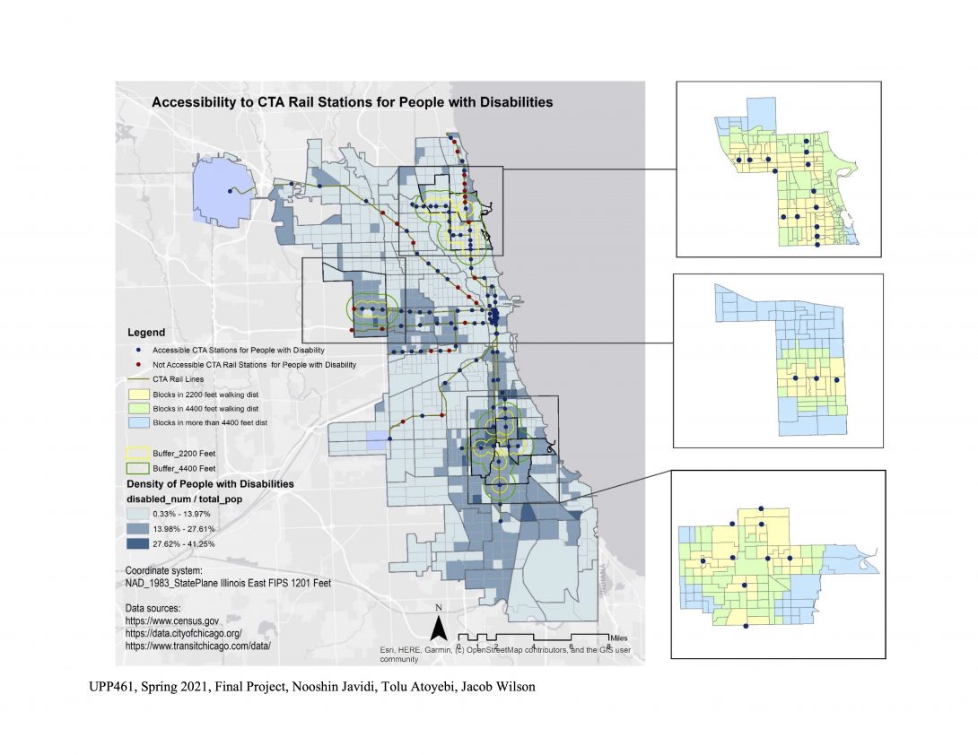
Authors: Jacob Wilson, Tolu Atoyebi, and Nooshin Javidi
Meeting the mobility needs of people with disabilities is one of the most urgent transportation projects in Chicago today. Transportation accessibility can be greatly enhanced for this group if efforts are made to develop mobility services beyond use of private vehicles, and to improve their ability to participate fully in society. For this research project, we seek to investigate the accessibility and the spatial distribution of CTA train service to disabled populations in Chicago. Additionally, we will analyze the proximity of disabled populations to CTA train stations, to help uncover more information on how well served the disabled population is. Ultimately, it is intended to overlay sociodemographic factors of race and income to see if any additional patterns arise.
Based on our research, most CTA rail stations radiate average ten minutes walking distance. Average of walking speed for able-bodied person is about 2.5 mph which would be equal to 2200 feet. Based on this speed, 3 Zones will be assessed:
1. 10 min walking distance to CTA train stations, 2200 feet
2. 10 – 20 min walking distance to CTA train stations, 4400 feet
3. More than 20 min walking distance to CTA train stations
Three areas in Chicago were selected to study their accessibility to CTA rail stations. We chose these study zones based on the areas with low, medium and high densities of people with disabilities.
4. Breast Cancer Incidence and the Availability of Free Mammography Services in Chicago, Illinois Heading link
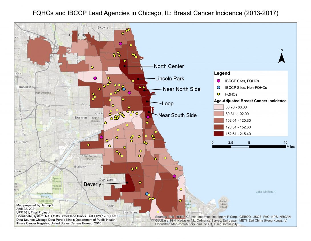
Authors: Maddie Levecke, Annie Dubnicka, and Sasha Johnson
6. Post-Earthquake FEMA Assistance to Vulnerable Populations in Puerto Rico Heading link
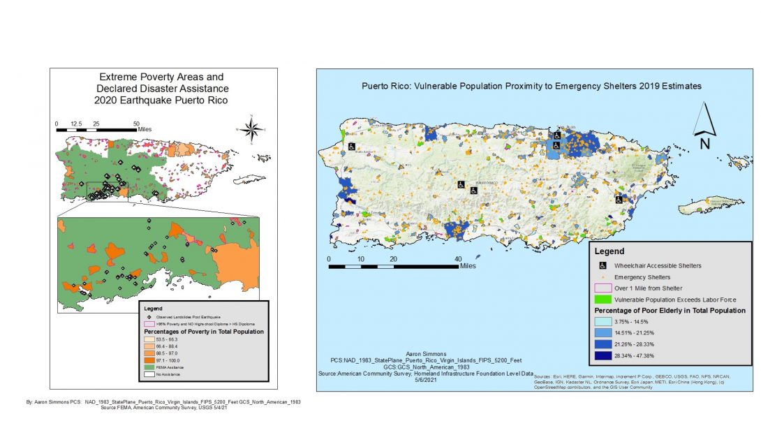
Author: Aaron Simmons
7. Determining High and Low Grocery Store Density in Chicago: What is truly influencing access and distance to grocery stores? Heading link
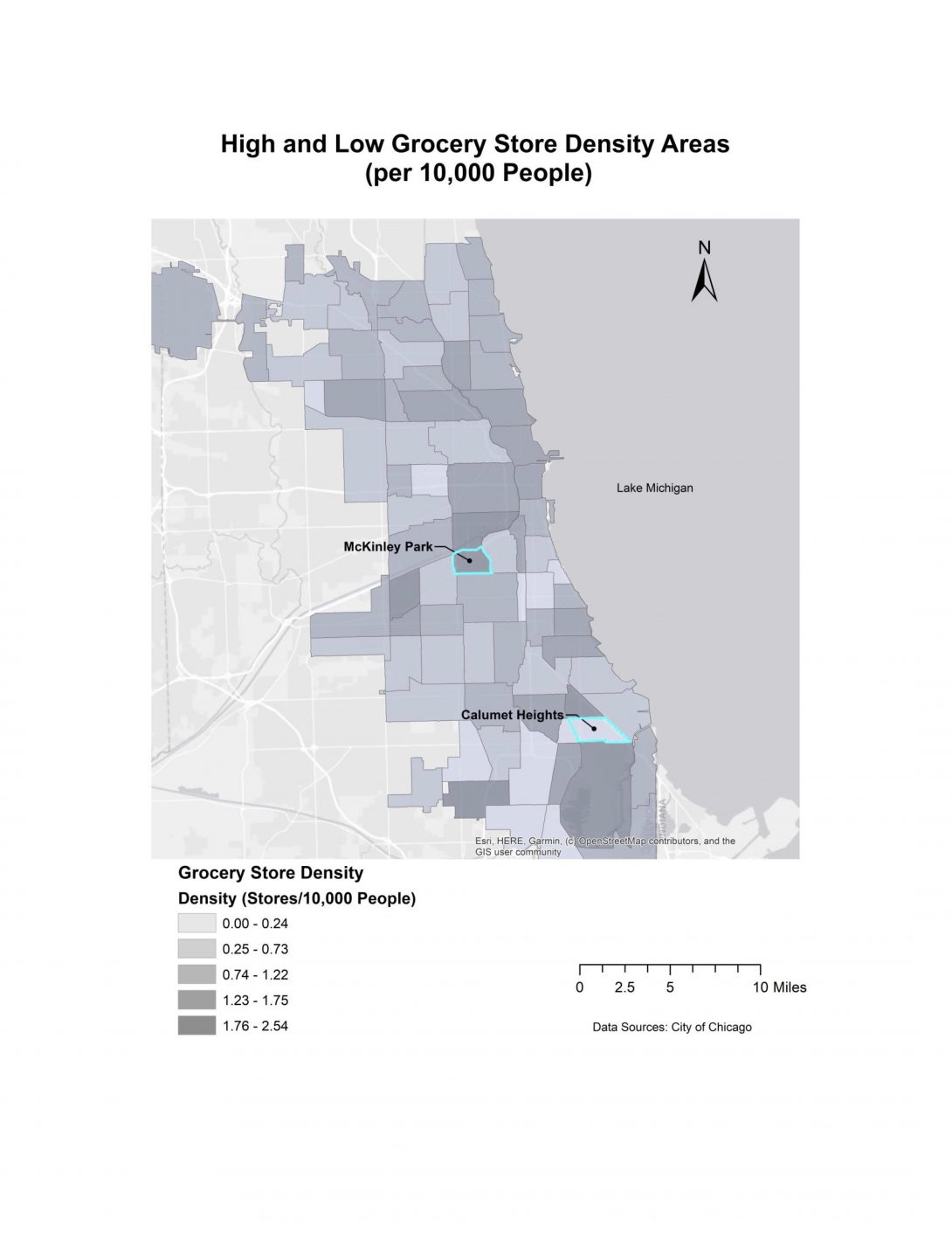
Authors: Lindsay Zasadzinski and Kai Thompson

9. Reducing the Number of Suburban Commuters Who Drive Alone to the Metro Station Heading link
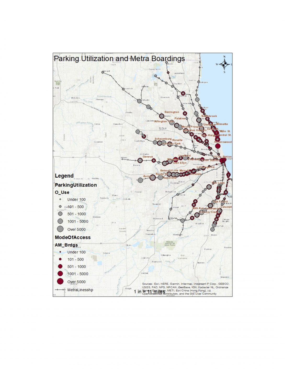
Author: Maggie Kochman